Map - Palikir (Palikir - National Government Center)

Palikir (Palikir - National Government Center)
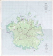
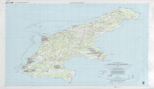
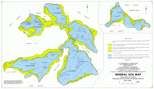
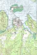
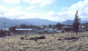
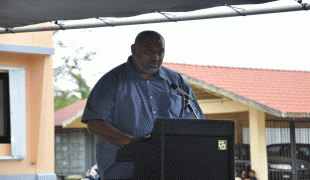
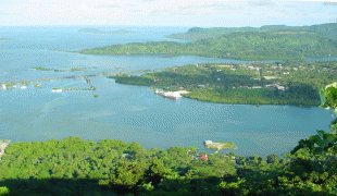
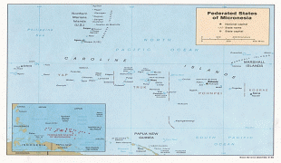
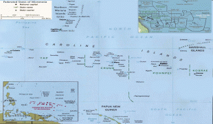
Palikir is the capital city of the Federated States of Micronesia located in the western Pacific Ocean. A town of slightly under 5,000 residents, it is part of the larger Sokehs municipality, which had a population of 6,647, out of the nation's total population of 106,487. It is situated on the northwest side of Pohnpei island (population 34,789), a high volcanic island surrounded by a fringing coral reef. Nearby to the northeast is the island's largest settlement, the coastal town of Kolonia. It was declared the capital of Micronesia in 1989.

Pohnpei was ruled by tribal chiefs in ancient times. Palikir was formerly a tiny village of little consequence. The island of Pohnpei was encountered by the Portuguese and Spanish in the 15th century, but colonial settlement did not occur until 1886 by the Spanish. Later Germany attained the Caroline Islands via purchase from Spain at the end of the Spanish–American War in 1898. During World War I control passed to the Japanese. During World War II, the Japanese built an airport near Kolonia. Subsequent to World War II, the island was administered by the United States Government until FSM attained independence in 1979. The government of the Federated States of Micronesia decided to convert the Palikir area into a town to house the central administration of the islands as a purpose built capital city. It was declared the capital of Micronesia in 1989. US aid of US$15 million was made available to develop the site into a modern town. All government offices, some residential houses, and the residence of the President of the Federated States of Micronesia were built. It is now the hub of the federal administration of the country, despite still being a village with a population of 4,645.

 
Map - Palikir (Palikir - National Government Center)
Map
Google - Map - Palikir
Google
Google Earth - Map - Palikir
Google Earth
Openstreetmap - Map - Palikir
Openstreetmap
Pohnpei_Island_munic...
6554x6924
upload.wikimedia.org
Saipan_USGS_1999_map...
5000x3738
upload.wikimedia.org
PohnpeiAirport.jpg
3648x2736
upload.wikimedia.org
Truk_Tol_soil_1981.j...
2500x1548
www.reisenett.no
PIA17934.jpg
1942x1495
photojournal.jpl.nas...
micronesie_kolonia.j...
1274x1892
www.populationdata.n...
Ponape.jpg
1768x1140
upload.wikimedia.org
_DCR0159.jpg
1600x1074
www.comfsm.fm
DSC_0249.JPG
1600x1063
3.bp.blogspot.com
DSC_0395.JPG
1600x1063
4.bp.blogspot.com
DSC_0868.JPG
1600x1063
1.bp.blogspot.com
Koloniasokehs.jpg
1441x953
upload.wikimedia.org
fsm-map.jpg
1267x1054
www.keteu.org
micronesia.jpg
1200x974
www.geographicguide....
Map_Chuuk_Islands1.p...
1198x946
upload.wikimedia.org
BlankMap-World-1ce.p...
1425x742
upload.wikimedia.org
1280px-Ponape.jpg
1280x825
upload.wikimedia.org
40_en.png
3400x300
static.bbci.co.uk
56_en.png
3400x300
static.bbci.co.uk
40_en.png
3400x300
static.bbci.co.uk
Country - Federated_States_of_Micronesia
Flag of the Federated States of Micronesia
The Federated States of Micronesia (abbreviated FSM) is an island country in Oceania. It consists of four states—from west to east, Yap, Chuuk, Pohnpei and Kosrae—that are spread across the western Pacific. Together, the states comprise around 607 islands (a combined land area of approximately 702 km2) that cover a longitudinal distance of almost 2700 km just north of the equator. They lie northeast of Indonesia and Papua New Guinea, south of Guam and the Marianas, west of Nauru and the Marshall Islands, east of Palau and the Philippines, about 2900 km north of eastern Australia, 3,400 km southeast of Japan, and some 4000 km southwest of the main islands of the Hawaiian Islands.

While the FSM's total land area is quite small, the country's waters occupy nearly 3 e6km2 of the Pacific Ocean, giving the country the 14th-largest exclusive economic zone in the world. The sovereign island nation's capital is Palikir, located on Pohnpei Island, while the largest city is Weno, located in the Chuuk Atoll.
Currency / Language  
ISO Currency Symbol Significant figures
USD United States dollar $ 2
ISO Language
EN English language
Neighbourhood - Country